Electric scooters are everywhere now, but the experience of actually using them is kind of a mess.
A dozen different rental apps that don't talk to each other. And once you're riding, you're basically on your own — most navigation apps are built for cars, not scooters.
I wanted to fix that gap: one app that shows you every available scooter nearby, no matter the provider, and then actually plans a route that makes sense for someone on two wheels.
Fragmented apps and car-first navigation don't work for scooters.
I talked to regular scooter riders about what frustrates them most, and the same themes came up: too many apps, bad routing, and no visibility into battery levels before committing to a scooter.
- Each provider has its own app — no single view of availability
- Google Maps routes optimized for cars, not scooters
- No way to check a scooter's battery range before starting
- No safety scoring for routes — some roads are genuinely dangerous
Research, infrastructure mapping, algorithm design, and testing.
Talk to real riders
Interviewed regular scooter commuters to understand the exact moments where existing tools fail them during a typical ride.
Infrastructure analysis
Mapped scooter-friendly infrastructure (bike lanes, pedestrian zones, surface quality) in several cities to understand what makes a route good.
Safety routing design
Designed routing logic that balances safety, speed, and battery life — factoring in road type, surface condition, and traffic patterns.
Prototype with daily commuters
Designed a one-handed UI that works while standing with a scooter, tested with daily commuters, and iterated on what they found confusing.
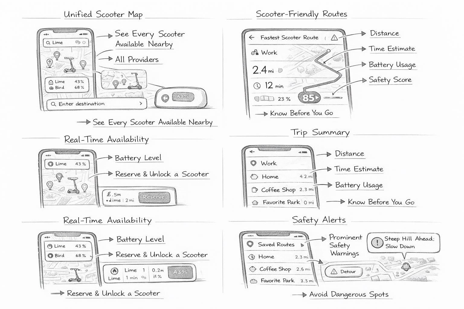
One map, smart routes, and a clear trip summary before you start.
Ridit pulls all nearby rental scooters into one map so you don't have to bounce between apps. Once you pick a scooter and set a destination, it builds you a route optimized specifically for scooter riding: bike lanes, pedestrian-friendly zones, and roads with good surface conditions.
Before you start riding, you get a clear trip summary: distance, time, battery usage, and a safety score for the route. No surprises when you're already on the road.
The best map is the one you don't have to think about while you're riding.